January 16, 2015
This morning, we said a very fond fairwell to the Pilgerhaus (Pilgrim House) in Tagbha. It was a wonderful place to stay, and I highly recommend it to pilgrims traveling to the area of northern Galilee.

I finally found the sheep that I knew were out there!
After making sure that all our luggage made it back onto the bus, we headed south along the western shore of the Sea of Galilee. Traveling through Tiberius, we had glimpses of the old Roman fortifications of that town. Established in 20 CE, the town was named after the Emperor Tiberius. It was the capital of the realm of Herod Antipas.
The town of Tiberius soon became so well known, that the inland sea was called the Sea of Tiberius by the Romans. However, the Hebrews continued to call it by it’s traditional name, Yam Ha-Kinerett (later just “Kinerett” and still later, “Genessaret”, and then”The Sea of Galilee”).

Date trees
After winding along narrow roads for about an hour, we left Israel and crossed the boarder into the West Bank. Soon we arrived at our first destination, the modern town of Jericho, located near the Jordan River on the West Bank. Jericho is 849 feet below sea level, situated in an oasis of the Wadi Qelt in the Jordan Valley.

Jericho Sycamore Fig Tree
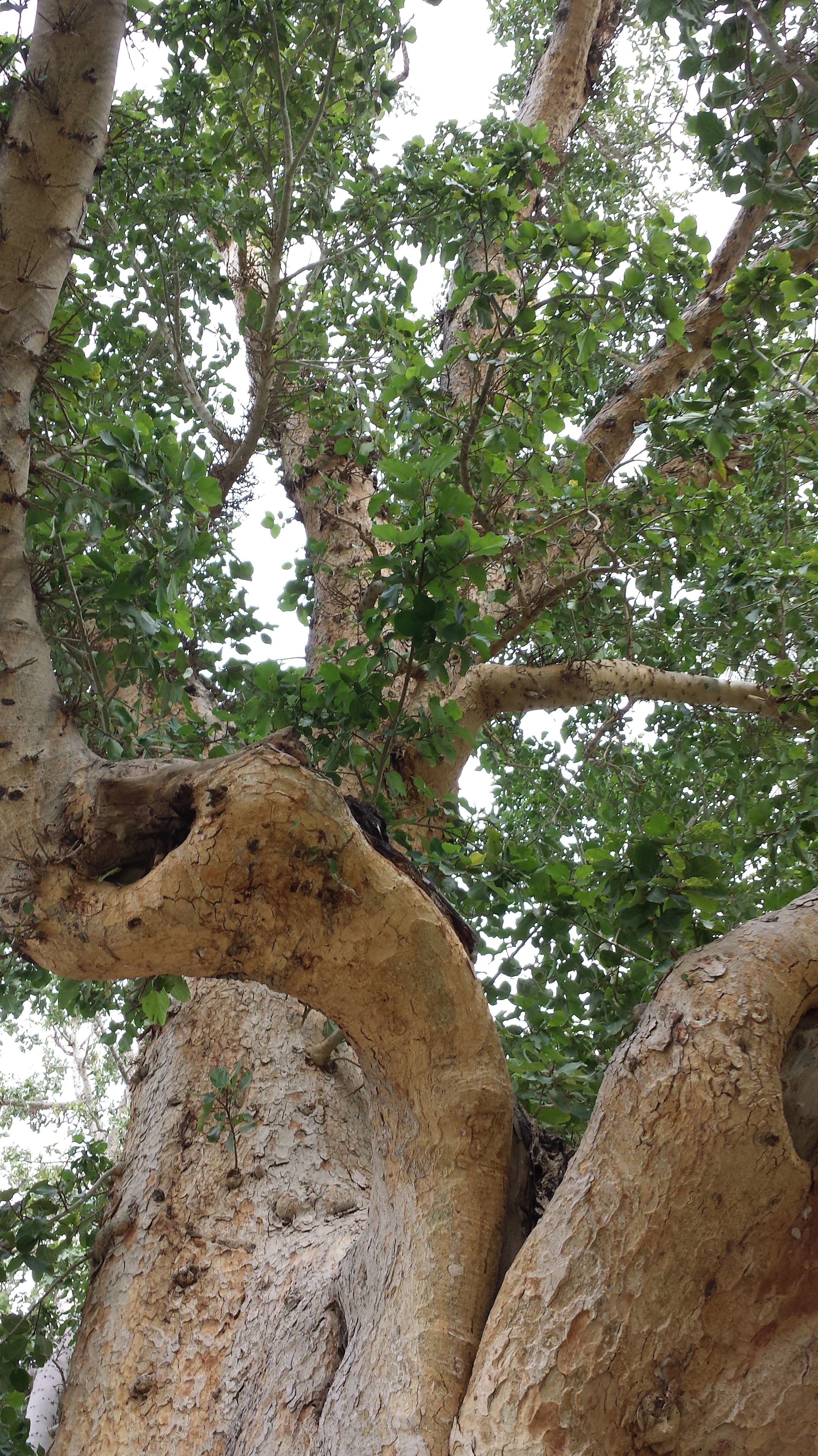
It’s a very big tree and deserves two pictures…
Stopping first near a large, old sycamore fig tree which locals like to say was the very fig tree that Zacchaeus climbed when he wanted to see Jesus through the crowds at during one of Jesus’s visits to Jericho (Luke 1-12). Whether this is THE tree is pretty doubtful, but is a very old tree, and is an example of the type of tree mentioned in the Scripture story. I’m sure you’ll be glad to know that I refrained from peeing on it. 😉
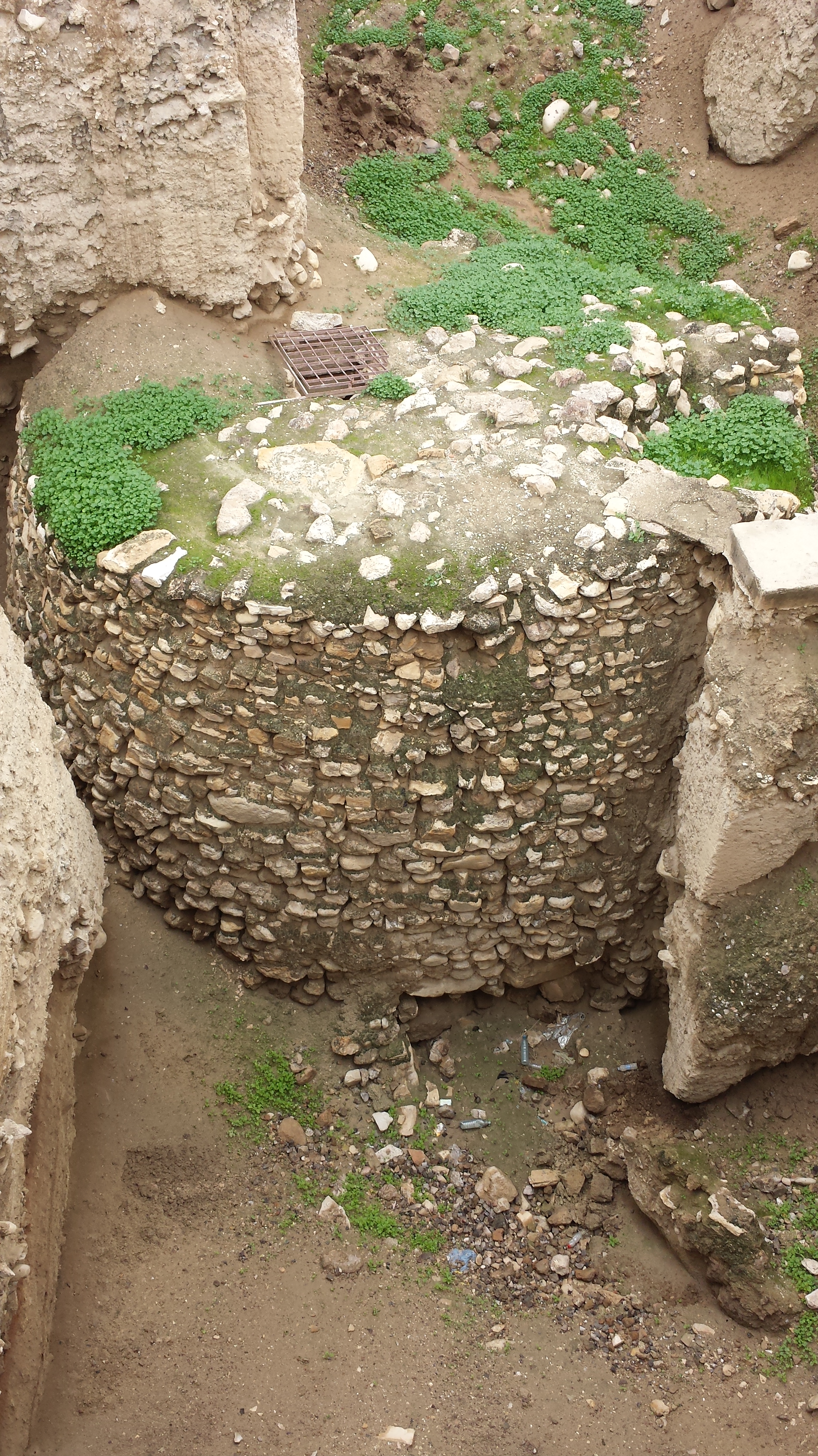
Fortress ruins in Jerico archaeological site.
After visiting the fig tree, we went to some ancient ruins of a fortress of some antiquity that had been refortified by Herod Antipas who had also built a winter palace at Jericho. Also, the Gospel story of the Good Samaritan is set in the area – a Hebrew man is traveling through the mountain valley pass from Jericho to Jerusalem when he is set upon by thieves.
The ruins are interesting but in need of better conservation.
Archaeologists have unearthed the remains of more than 20 successive settlements in Jericho, the first of which dates back 11,000 years (9000 BCE). It was an early religious center for the Canaanite people, and the name “Jericho” is a Hebrew word derived from the Canaanite word for “moon.”
The destruction of the city (“when the walls came tumbling down”) actually occurred quite sometime before the Israelites migrated to the area, but it’s likely that they discovered the ruins and developed a story to explain them that also underscored their rise to dominance in the area during the Hasmonean Empire (a Hebrew dynasty descending from the Tribe of Levi, c. 110 BC).
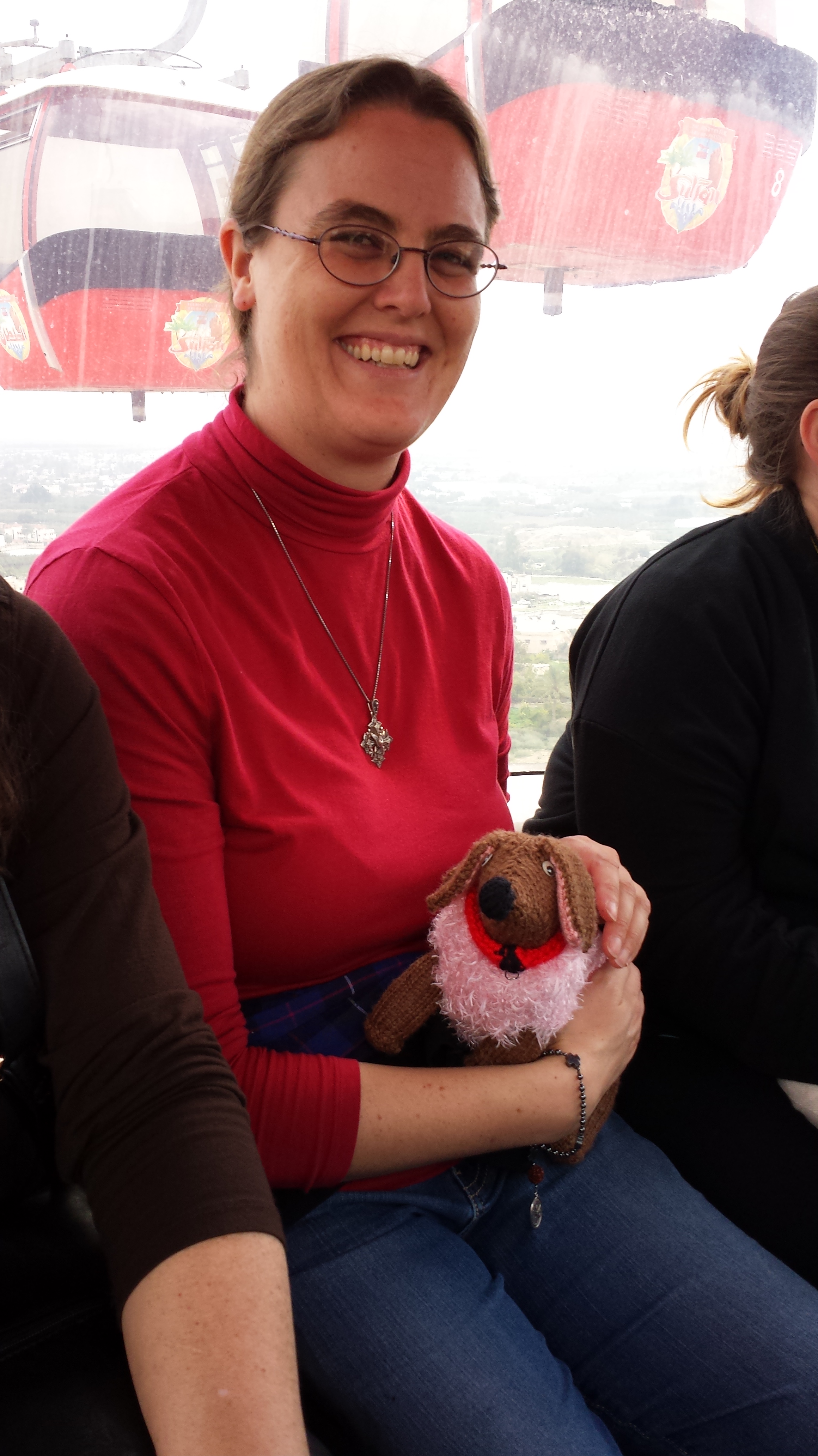
With new friend Emily on the cable car going up to Mt. Temptation.
After exploring the fortress ruins, our group drove over to a cable car station that takes people up to the top of a low mountain known as The Mount of Temptation. Christian tradition attributes this mountain as the location of Jesus’ time of discernment in the wilderness. Their are many caves set into the sheer sides of the mountain, many of which are still used to this day by monks, hermits and shepherds.

Freshly squeezed pomegranate juice made from some of the largest pomegranates I’ve ever seen!
Before boarding the cable cars, many of us stopped to grab a quick cup of freshly pressed pomegranate juice. YUM!!
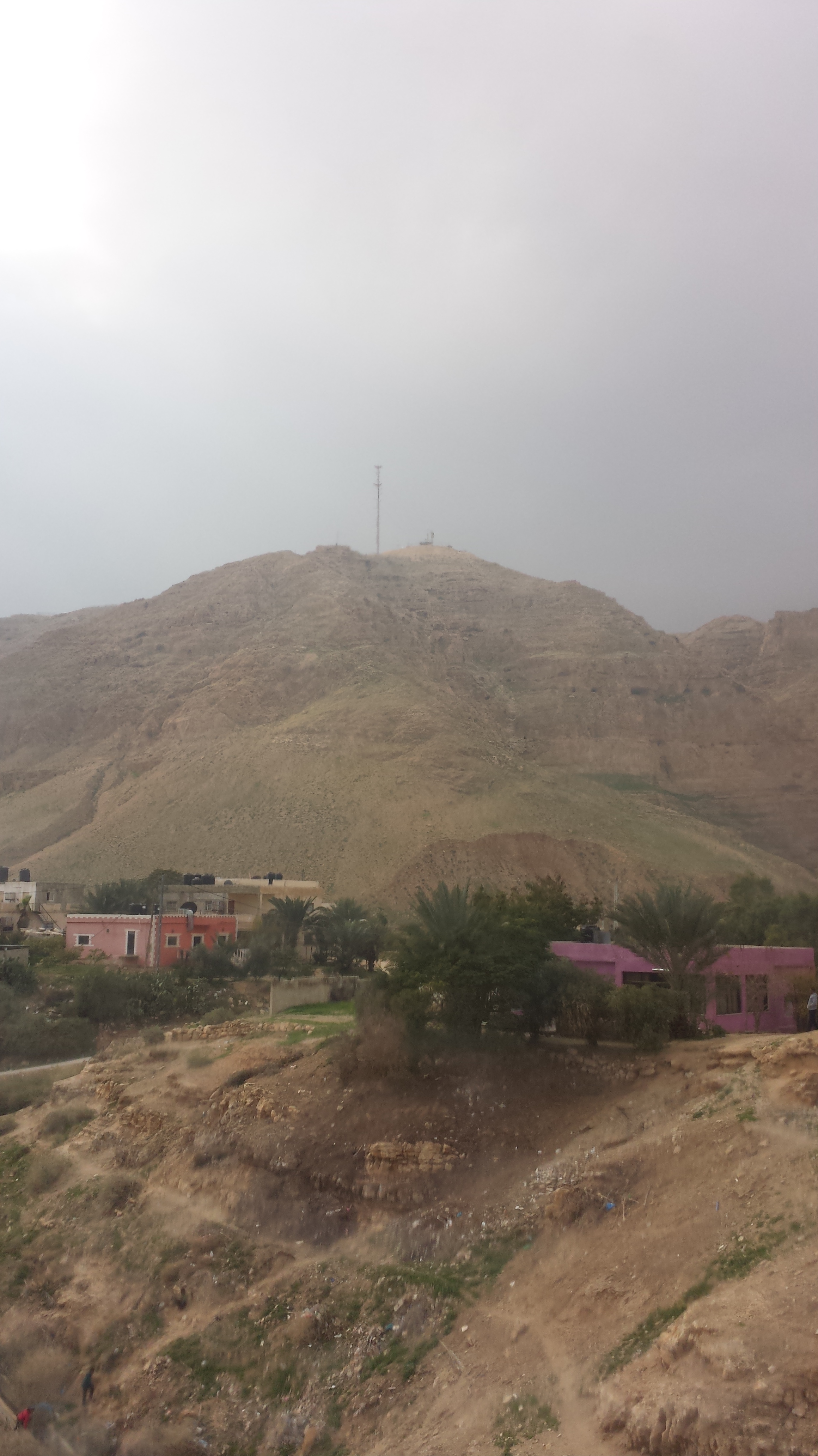
Mt. Temptation
Traveling in the cable car up to the “Temptation Restaurant” at the top was a lot of fun, with pauses in the ascent now and then for others to be loaded into cars either above or below us.
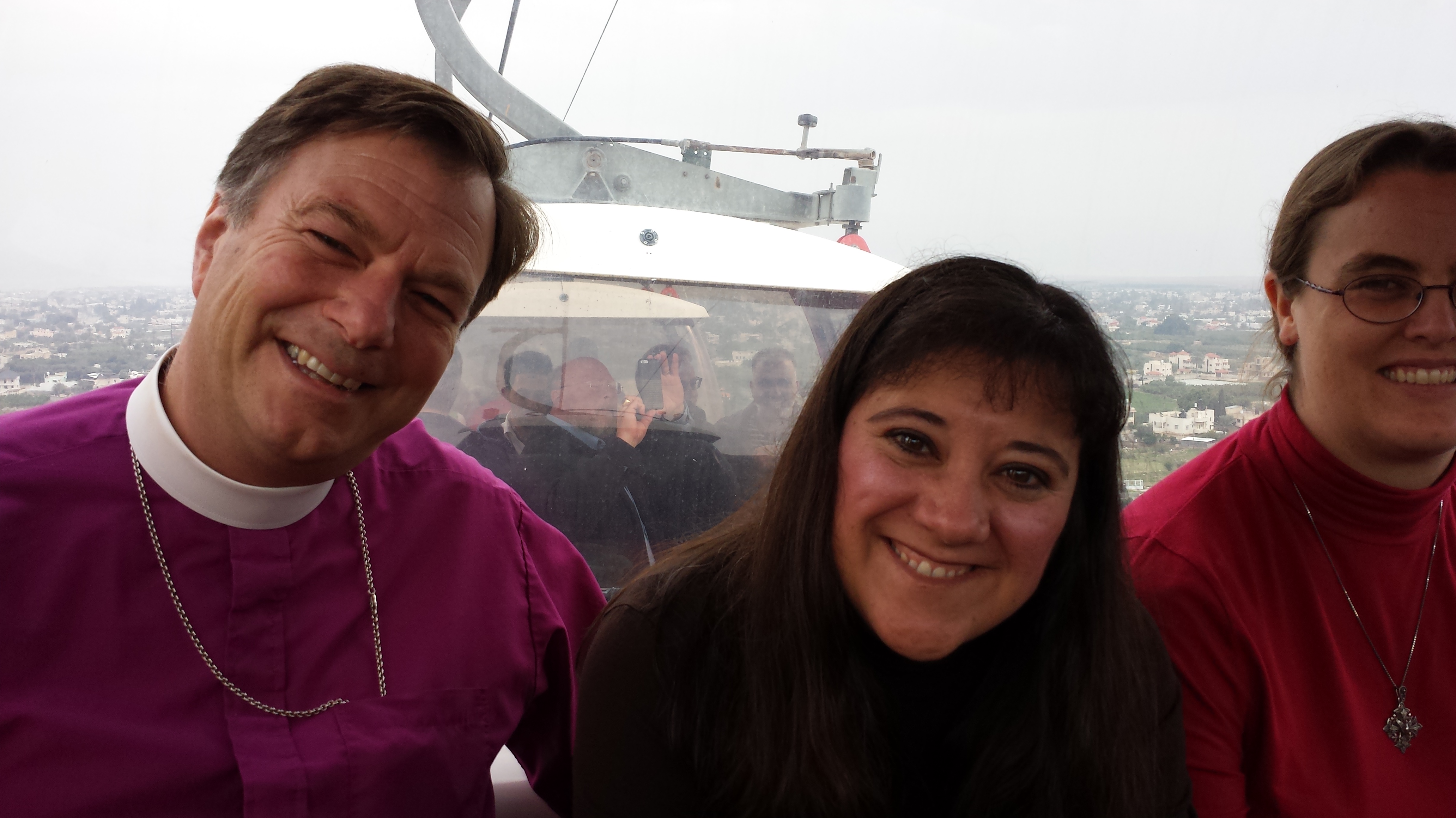
Marti didn’t like it when the car paused or went over the tower juntions, but she’s smiling nonetheless.
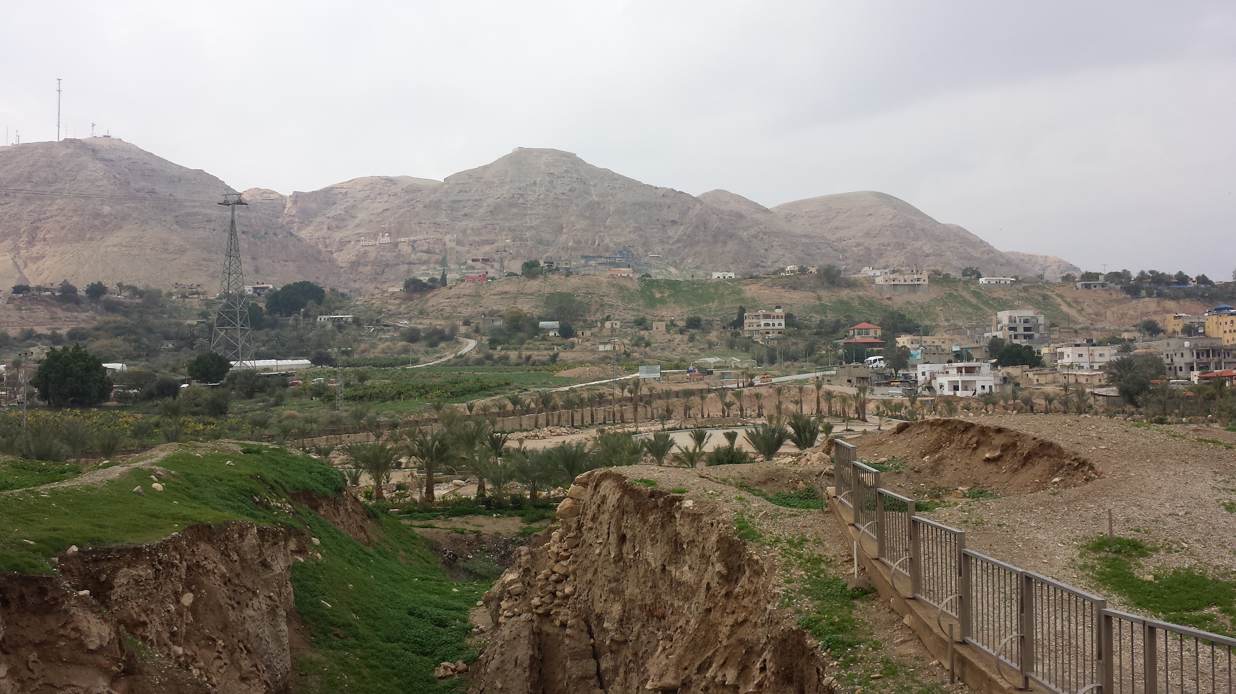
The view from the top gives a sense of Jericho today.

The view of Jericho from the top of Mt. Temptation.

Rachel and I at the top.
We didn’t eat at the restaurant (as “tempting” as that was!) but took the cable cars back down to eat in a pilgrim restaurant below. Outside where we ate, I met a flock of very nice peacocks.


Outside our restaurant.
After lunch, we did an amazing thing. We drove to a site along the Jordan River that hasn’t been open to the public in a long time, due to conflicts between the countries of Israel and Jordan. The Jordan River is the boarder between Israel and Jordan, so it is a place of much tension.
Armed guards on both sides of the river keep careful watch over those who come to visit the waters. We could see them as we waded into the river and gathered water to bring home with us.

This picture is taken from the Israel side of the Jordan. The open structure on the other side is in Jordan. Inside it are armed Jordanian soldiers who are keeping a close eye on us.
During our drive into the river area, we passed through the gates of a “No Man’s Land” swatch of territory that is actually a mine field with fencing on both sides of the swatch.

Traveling through no man’s land to Israel’s border with Jordan.
However, even in the midst of all of these signs of tension, we found a moment of real peace as Bishop Greg led us through a renewal of our Baptismal promises and then anointed each of us by name.
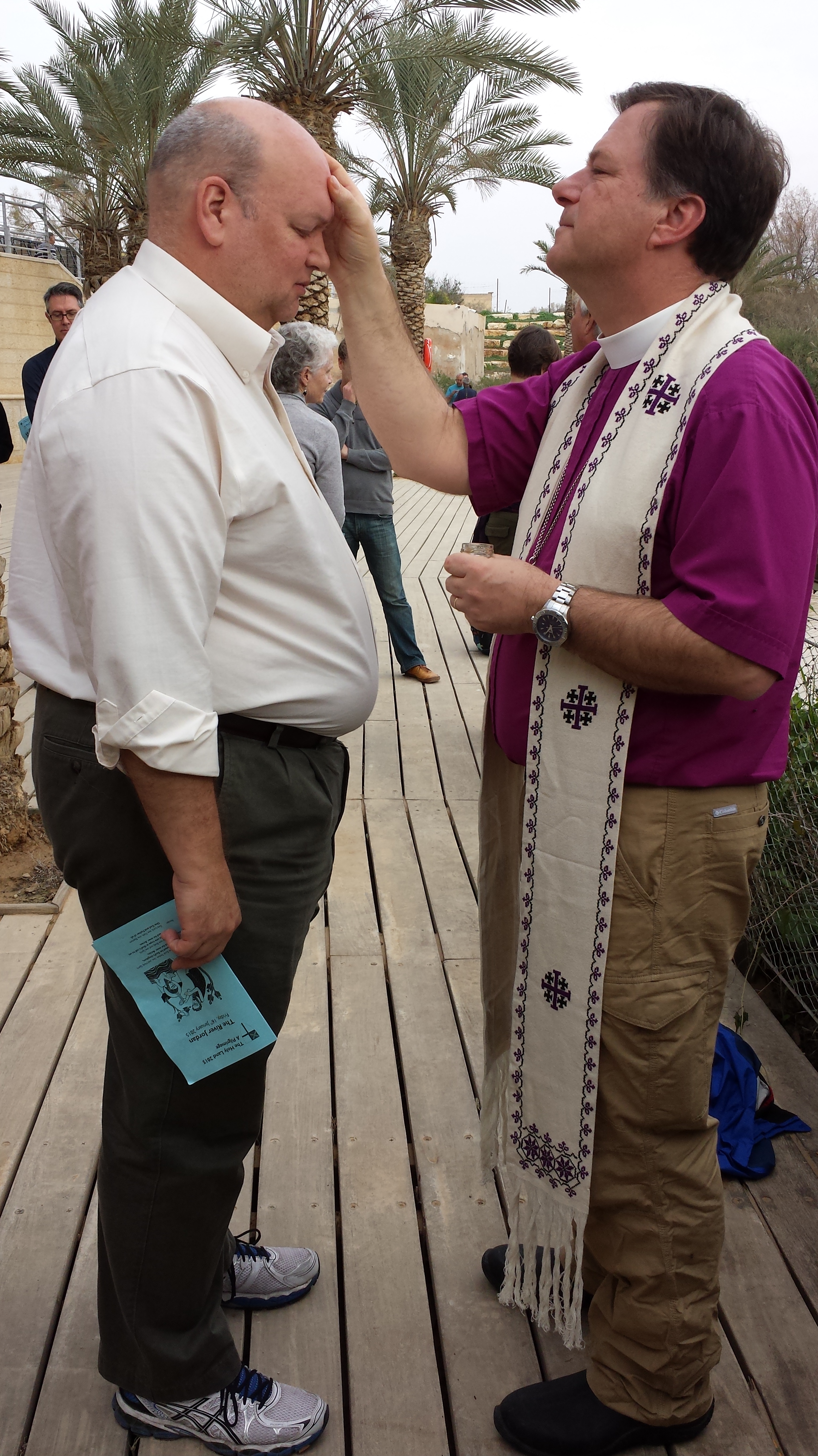
Bishop Greg anointing Dean Steve Thomason of St. Mark’s Cathedral.
The water of the Jordan River is very silty in this place, and the mud fine and squishy – much to our remark as we waded along the wooded steps set under water at its bank.
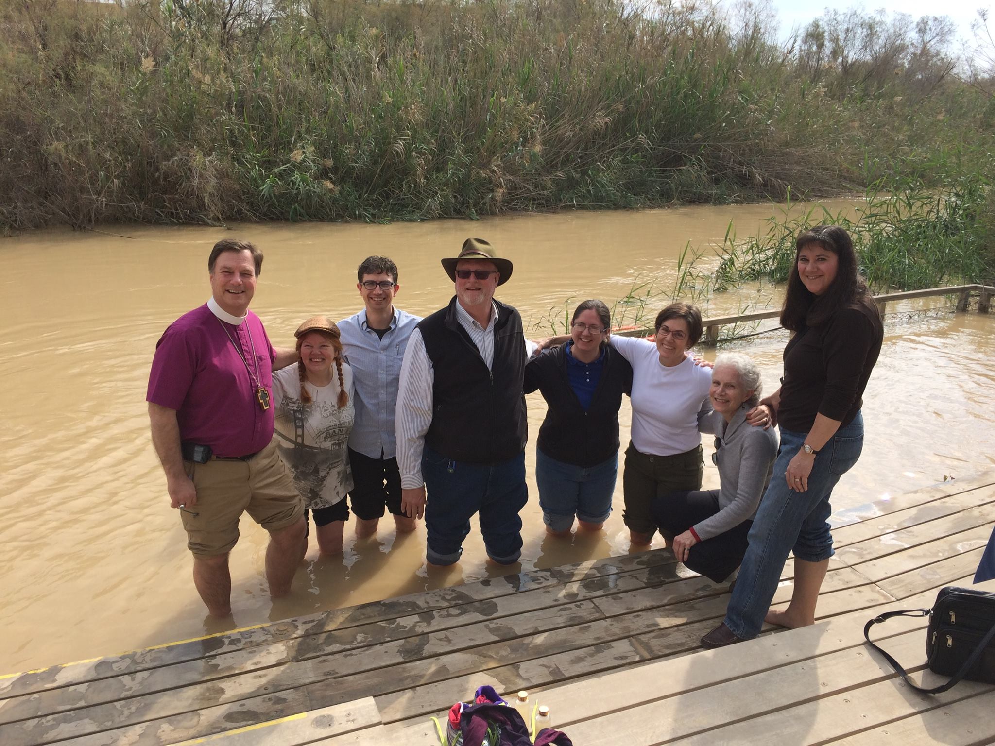
Pilgrims from the diocese of Olympia hanging out in the very cold waters of the Jordan River.

Me and Marti Rickel collecting river water to bring home. The river is very silty here because it flows quickly and stirs up the thick, soft mud in its banks. It settles out quickly in a still bottle.

I love this picture!
Once our time was done, we drove back through the mine field, out through the Wadi Qelt and up through a pass to Bethany. Gaining lots of altitude very quickly, we passed several modern Bedouin encampments. These encampments are a mix of old and new – children herd goats and sheep, families build huts of corrugated metal; the port water into their camps and many have generators and televisions. The Bedouins are a people on the move, moving their camps according to season and location of good grazing for their goats, sheep and camels.

The small shacks are a Bedouin settlement.
Bethany is a Palestinian town that has been separated from the nearby city of Jerusalem and the Mount of Olives by the Israeli Separation Wall. Thirty feet high and 430 miles long, the Separation Wall was built by Israel as a security barrier separating Israel from the West Bank. However, often the wall makes deviations into Palestinian territory. The wall has a very negative impact on the Palestinian economy and makes travel very challenging.

The Separation Wall blocks the road.
At Bethany, we stopped in a church dedicated to the memory of the raising of Lazaras, who (along with Mary and Martha) were very close friends to Jesus. He seems to have visited them frequently when in the area of Jerusalem.
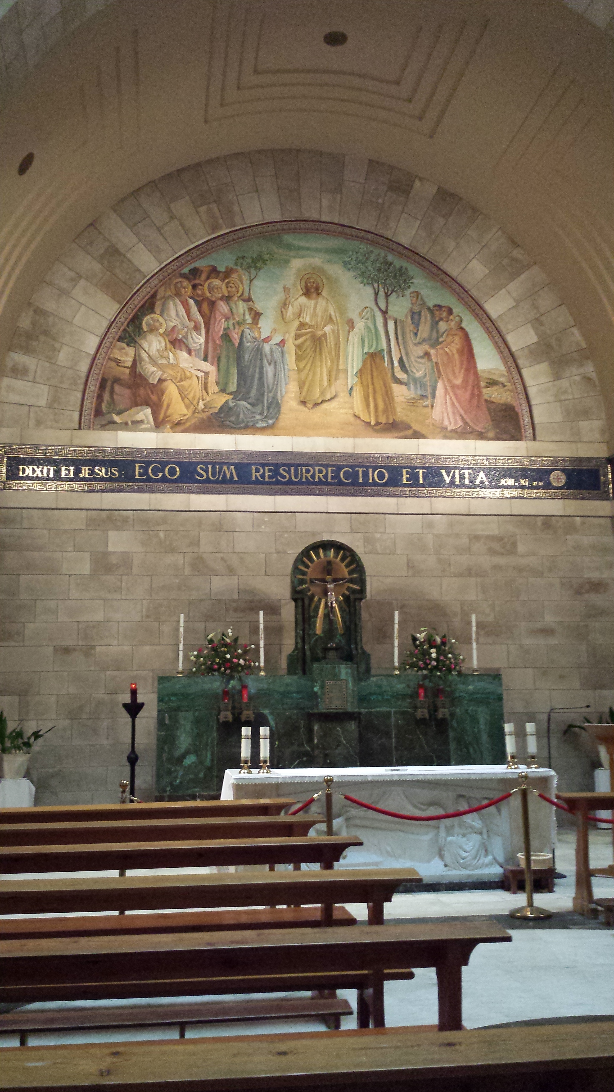
Inside the Church of Lazaras, Bethany.
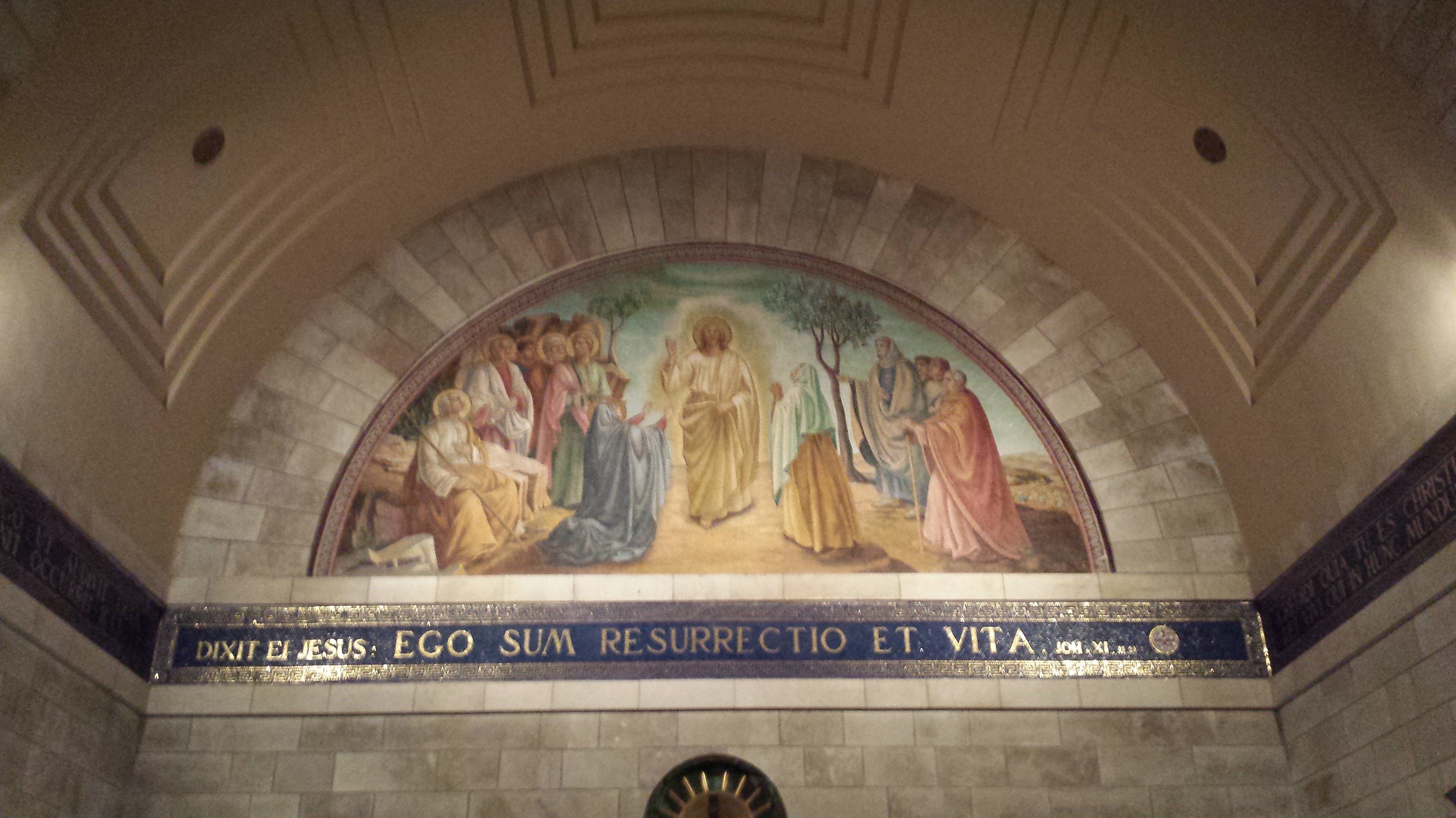
The church has some antiquity at least going back to the Byzantine era, and it has beautiful acoustics. The song during our brief prayer service there was very moving to us Anglicans, who love a well-sung hymn! David Spring would have liked this very much.
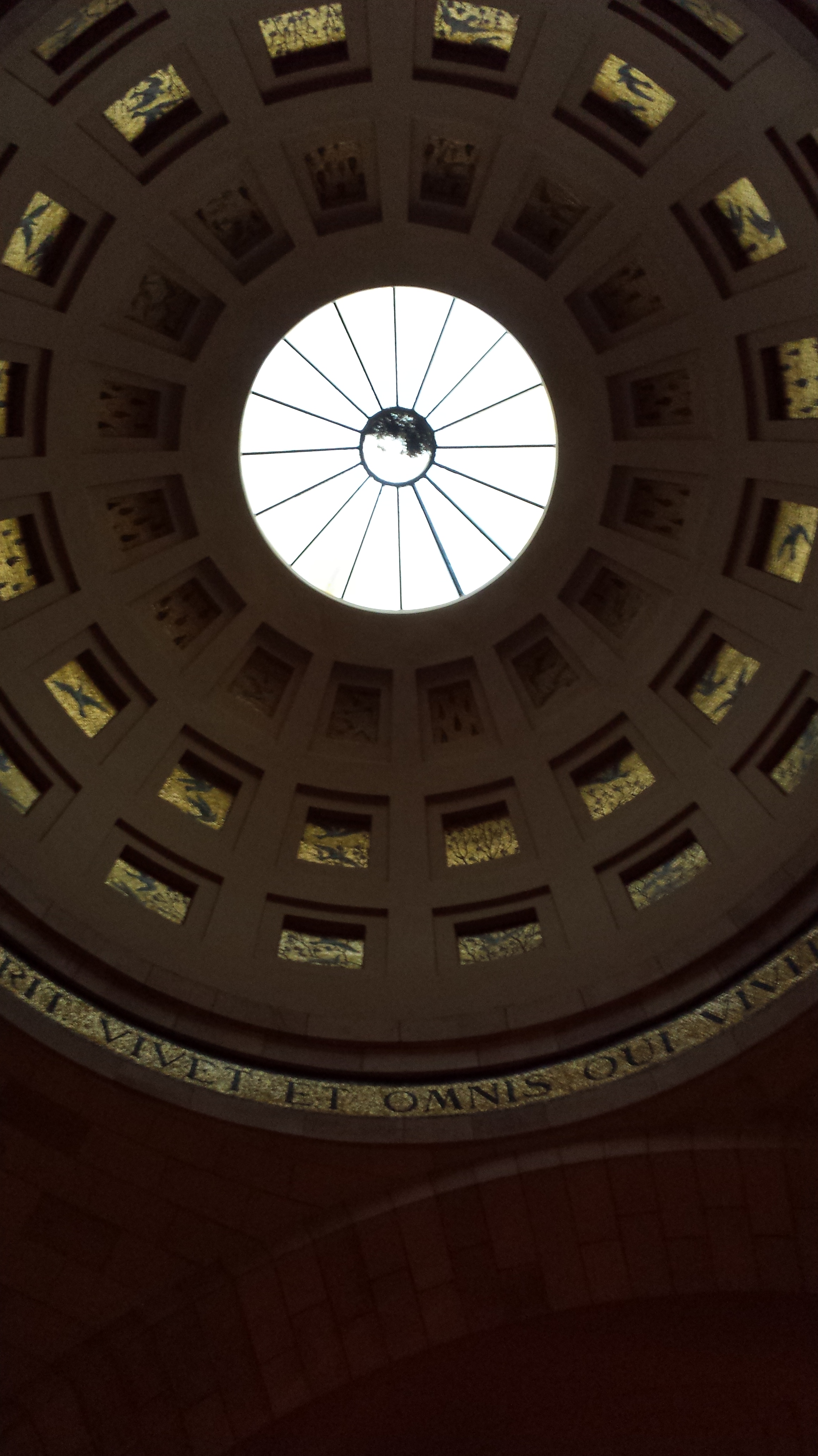
Dome interior.
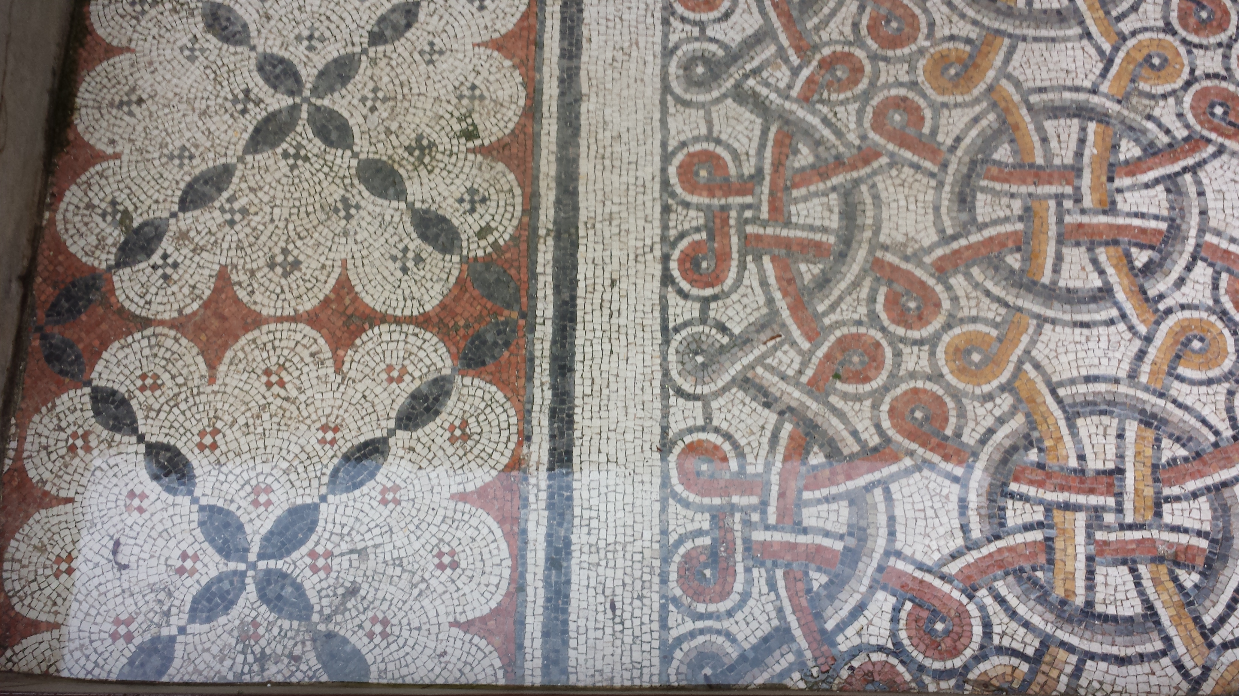
Remnant floor mosaics from Byzantine era of the church.
Once again aboard our bus, we had to drive around the Separation Wall blocking the direct route to Jerusalem. We stopped in Jerusalem just long enough to drop off our guide to retrieve his own car before continuing our caravan to Bethlehem.
This portion of the Separation Wall runs through Bethlehem.
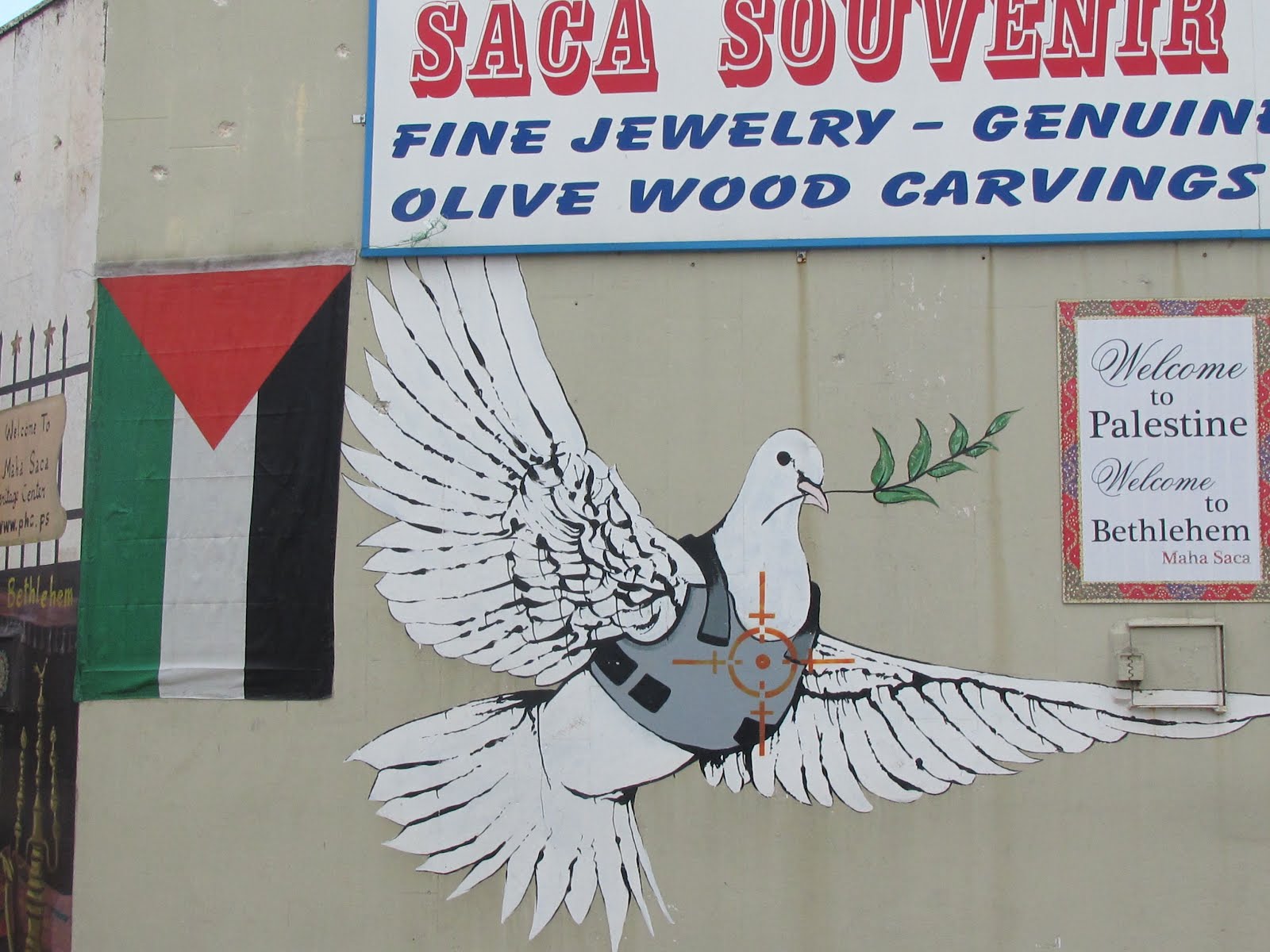
The bishops decided to take us to shop at Christian cooperative gift shop that supports about 70 families of Palestinian Christians still living in Bethlehem. As with Bethany, the economy of Bethlehem is highly impacted by the Separation Wall that excludes it from easy access to Israel.
We were glad to do “exert our economic power” as Dominic put it and support the Christian community by basically shopping our brains out at the cooperative.

My room at the Casa Nova.
Finally, we made the last few minutes of our Journey to our hotel..which is amazingly located on Manger Square, only feet away from the entrance of the Church of the Nativity.
After supper at the hotel and prayer in the nearby Franciscan Chapel in the church complex, it was off to bed after a very full day. So many thoughts and emotions are running through my head, that all the reflection is exhausting but important.
Here’s to Barking at Squirrels!
Henry
Manger Square in Bethlehem is still decorated for Christmas, and the Armenian tradition celebrates Christmas Eve tomorrow. Jerry Christmas!
